Medicine Bow Peak, WY
- Jun 28, 2025
- 2 min read
Updated: Jan 31
6/28/2025
The highest point in the Snowy Range in south central Wyoming at over 12,000 feet tall, Medicine Bow Peak was a nice acclimatization hike. This area is the crown jewel of the Medicine Bow mountains, with pretty meadows, lakes, and some surprisingly alpine scenery that are easily accessible from Highway 130.
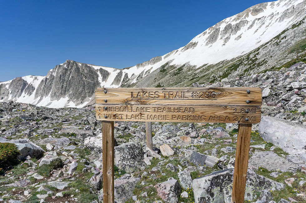
There are multiple trailheads that hikers use to access Medicine Bow Peak. We chose to use the Lewis Lake trailhead because it is the shortest and most straightforward route. The only issue is that we were there early in the summer (late June), so the road into the trailhead hadn’t been opened yet and there were still significant patches of snow covering the roadway in places. This road walk only added an extra mile each way, so we were happy to take the scenic route. A few snowbanks were still melting out, but plenty of people had walked on them and the snow was nice and consolidated, so they hardly hindered our progress.
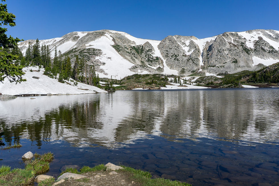
Upon reaching the trailhead, we were treated to a nice view of Lewis Lake. It’s a unique experience to be on the shore of a pristine alpine lake at nearly 11,000 feet and turn around and see a trailhead with a bathroom right behind you. Very different than my normal mountain adventures in Washington state!
The lower parts of the trail were still predominantly snow covered, and we had to take our shoes off to wade the small creek between Lewis and Libby Lakes, so our hike was a tad bit trickier than if we had done it in mid-summer, but we were soon climbing above the snow to the saddle between Medicine Bow Peak and Sugarloaf Mountain.

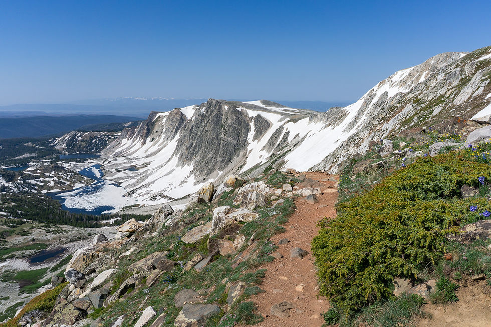
My dad had climbed Medicine Bow Peak previously and decided he was content to take in the views here and let me dash up and tag the peak. The views were special, looking down at a chain of sparkling lakes with big rocky cliffs providing a dramatic backdrop.
The rest of the trail consisted of tight switchbacks that zigged and zagged up Medicine Bow’s east face, before culminating with some light scrambling and snowfields at the summit. I only briefly had to touch snow to climb up to the summit ridge and did so without difficulty. I tried to push my speed up the final 900 feet from the saddle and was very pleased with how my body was handling the altitude!


The way down was fast, but we made sure to take time to savor the views and the cloudless day. A few more snow crossings and the creek ford brought us back to the trailhead, and we briskly finished the last mile of road walking, returning to the highway about 2 hours and 50 minutes after we left it. This would be an even shorter outing if you could drive to the trailhead and if there was no lingering snow.


Final Stats: 5.2 miles / 1300 feet of gain


Comments