Mount Clark
- Jun 28
- 5 min read
6/28/2026
I was in need of a big day in the mountains, but June-uary wasn’t cooperating with my plans. Just about everywhere in Washington and BC was forecast to experience cloudy conditions with some light rain over the weekend. After studying some weather models, there appeared to be a short-lived gap in the clouds over the rain-shadowed northeast part of the Olympics on Sunday morning. I decided to capitalize on this by making a quick visit to Royal Basin, with the hope of climbing a peak while I was out there.
The drive out to the Dungeness River trailhead was easy besides a few bone-rattling potholes near the trailhead, and I got started at a respectable 7:15 am. Ideally, I would have liked to sleep in my car the night before and start earlier, but this would do.

The hike in was uneventful, and I really enjoyed the beautiful river views and moss-covered areas on the way. After 6.6 miles of hiking I cruised into Royal Lake. Clouds had started to build right on cue, but it seemed like the weather was still holding nicely! Royal Lake itself was beautiful from afar, but when I got closer it turned out to be kind of a backwater, with some murky algae floating on the surface. It was here that I started to run into a few groups who had camped in the basin the night before who were beginning their treks back to the car.


The final 600-ish feet of climbing past the lake to the upper basin was gorgeous. I passed maybe the largest boulder I have ever seen (at least a hundred feet tall and just as wide) and traversed a scenic meadow with views back down toward Gray Wolf and Blady. The real highlight, though, was the turquoise tarn in the upper basin. It was so blue it didn’t look real!


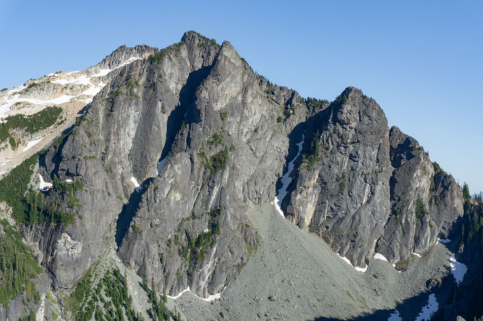
I took some time to appreciate the tarn and the awesome views of Deception and Mount Clark, one of my options for the day, which loomed large and craggy above the tarn. The weather was decidedly becoming more unsettled as predicted, but was staying precipitation free, so I decided to give Clark a shot. I hadn’t done much research before but knew there was a “corkscrew” route with fun scrambling.
I crossed over the tarn’s outlet stream and began picking my way up heather and talus to reach the basin below the peak. Here I got a good look at the snow-filled basin, which also held a post-glacial meltwater lake that was a beautiful Gatorade-blue color. Plentiful icebergs were floating on the lake’s surface.


I dropped down a hundred feet or so on snow and circumvented the lake on the southwest side. The climb up to the ~6900’ col between Clark and Johnson went with no real difficulty. I switched between snow and rock when necessary, and chose to claw my way up some loose scree to reach the col rather than go up a few feet of steep, icy snow to gain the col.
Now I found myself at the beginning of the famed corkscrew route. It was very clear where the first ramp was. It went up the southwest-facing cliffs of Clark and looked like it was designed for climbers. It was no more than class 2 and was so wide it didn’t feel exposed at all. At the end of this ramp, I climbed an obvious gully to reach a notch in the ridge.
Clouds were threatening to engulf Clark’s summit, but everything remained dry, so I pressed on into the unknown on the far side of the ridge. Having done little research, I was surprised to see what looked like a significant downclimb ahead of me. I could see where the route became obvious again at the base, so I surmised that downclimbing was the correct move here. I followed a diagonal crack system down, utilizing a well-placed small pine tree to help negotiate the final toughest bit (class 3+ or 4). I felt confident I could climb back up that section no problem, so I continued on.
Beyond the downclimb, I did some more horizontal traversing, avoiding a few snow patches in the process. I reached another, larger, section of snow and it became clear that the horizontal traverse was over, now it was time to go vertical! I scrambled up a perfect moat between rock and snow with one class 4 step that didn’t feel exposed thanks to the moat. I popped out of the moat and followed more class 3 rock up to near the summit.
It was surprisingly hard to tell what the true summit was until I was basically right underneath it. A few more solid, class 3 moves brought me up to the tippy top. I was officially in a cloud, but the various spires and needles below me were coming in and out of the murk, which made for a really dramatic summit experience after an exhilarating climb.


I didn’t waste long on the summit because I couldn’t see anything, and I wanted to get off the rock before the rain finally found me. Downclimbing the class 4 section in the moat was actually easier than climbing up because I was able to kick a nice foothold into the snow. The climb up the diagonal crack was also easier than the way in, and I was back to the col before I knew it.
Some boot skiing and scree-surfing brought me back down to the Royal Basin tarn for a well-earned lunch. To my surprise, the weather had actually gotten better since I was on the summit, which was now out of the clouds, and patches of blue had returned to the sky.


After lunch and like 20 more pictures of the tarn, I began my long hike out. It went without issue, and I returned to my car just as some misty raindrops began to fall – 8 hours and 52 minutes car to car. I had timed things perfectly!

Final Stats: 19.9 miles / 5200 feet of gain


That water is stunning!!