Argonaut Peak
- Aug 9, 2025
- 4 min read
8/9/2025
Mike and I day-tripped Argonaut Peak via the South Route. Starting at the Beverly Turnpike trailhead at 6:22 am, we cruised up the (familiar to me) Beverly Creek trail for 2.6 miles and 1585 feet of gain. Here we made a right-hand turn and took the Fourth Creek trail, which climbed another 0.3 miles and 300 feet up to a pass, before descending into the Fourth Creek valley. By the time we hit Ingalls Creek, we had covered about 5.5 miles in about 2 hours.
Ingalls Creek needed to be forded to access the Ingalls Creek trail and the Argonaut climbing route. I’m sure there were logs or easier rocks that someone could find to cross, but since it was a warm summer morning, we opted to just take our shoes off and wade through the ankle-deep water. Some submerged, slippery rocks made the footing a bit tricky, but overall, the crossing was simple and the icy footbath felt great.

After putting our shoes back on and negotiating a few blowdowns, we reached the Ingalls Creek trail. We turned right and headed east on the trail for about 8 seconds before promptly diving off to the left at a clearing and beginning our ascent of Argonaut.
There were traces of either climber’s or game trails here and there lower down on the climb. In some sections early on the tread was actually quite well defined but it eventually petered out when we came to the worst part of the day at around 4800’. Here we found a maze of downed trees that were scattered and jumbled like matchsticks in every direction. We did our best balancing acts and were able to zig zag through this section eventually, but it was definitely a pain.
Beyond that, we miraculously found traces of a trail again and made good progress steeply upward. We had to push our way through one section of thick slide alder that wasn’t too pleasant, right before an open boulder field. We eventually broke out of the trees for good and ascended a gentle but steep ridge until about 6400’. At this point, we began dropping climber’s right into Argonaut’s large main gully.
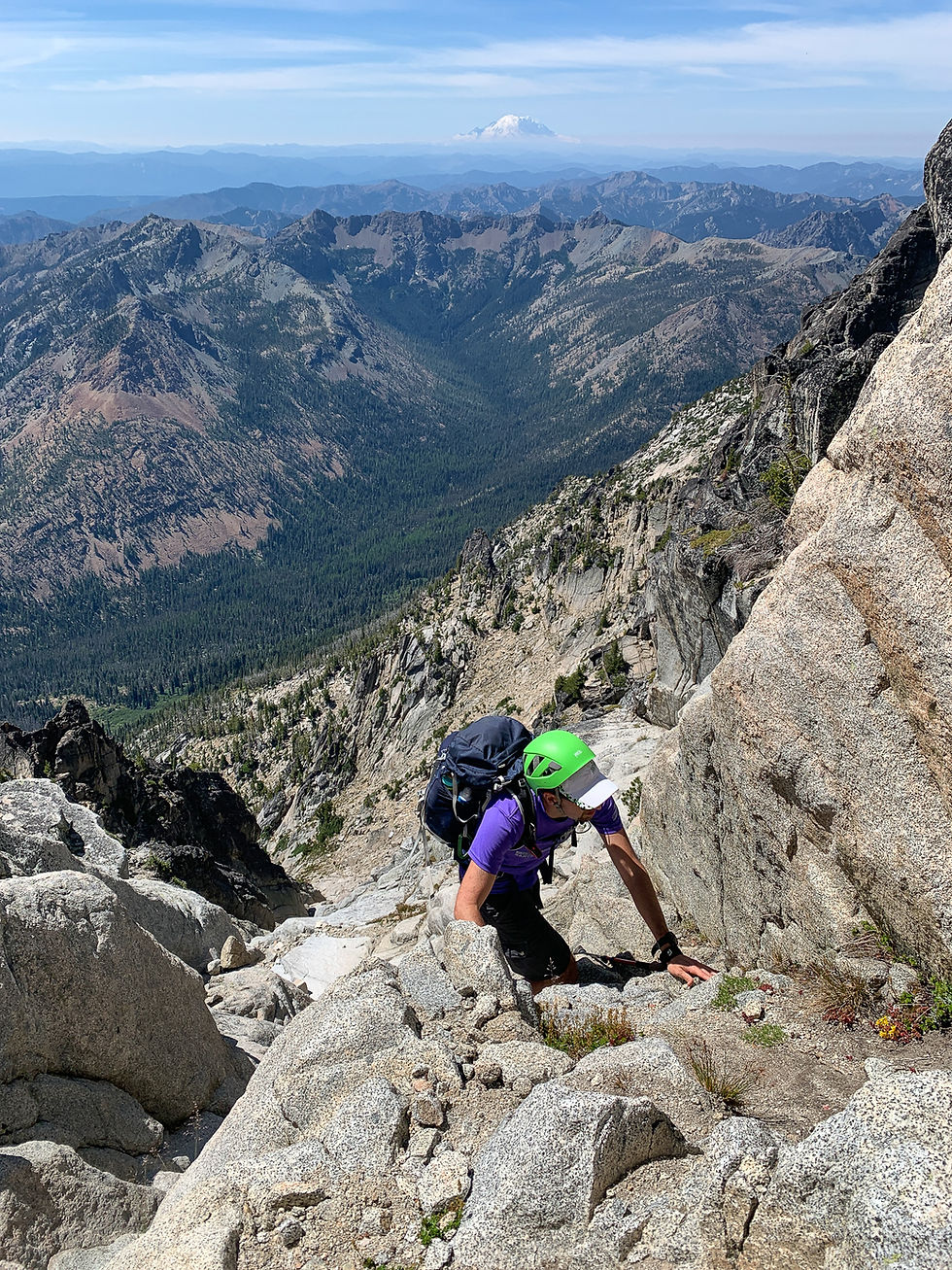
Once in the gully, some fun bouldery scrambling brought us up to where the gully splits in two at 7100’. We took the left gully, which is the standard route. Beyond the split, the scrambling steepened and became more sustained. There were several class 3 moves with mild exposure, but it was all on grippy rock, which made for a fun mountain playground.
Mike and I climbed all the way until we were traversing below the summit face, where we encountered the crux of the south face route. A 50-foot gully with a chockstone at the top was separating us from gaining the east ridge. Ever the conservative climbers, we had brought a 60 m rope (overkill, I know), and a few cams to protect the gully. The chockstone is climbed with a class 4 move or two, but the exposure would make a slip very consequential. I led out, placing one #1 in a crack, and then used an existing fresh piece of webbing that was attached to the anchor to clip into to protect the final move. I gave the webbing some good tugs and inspected the material before clipping. The class 4 move was indeed a bit exposed, and I was glad to be protected as I pulled myself up.

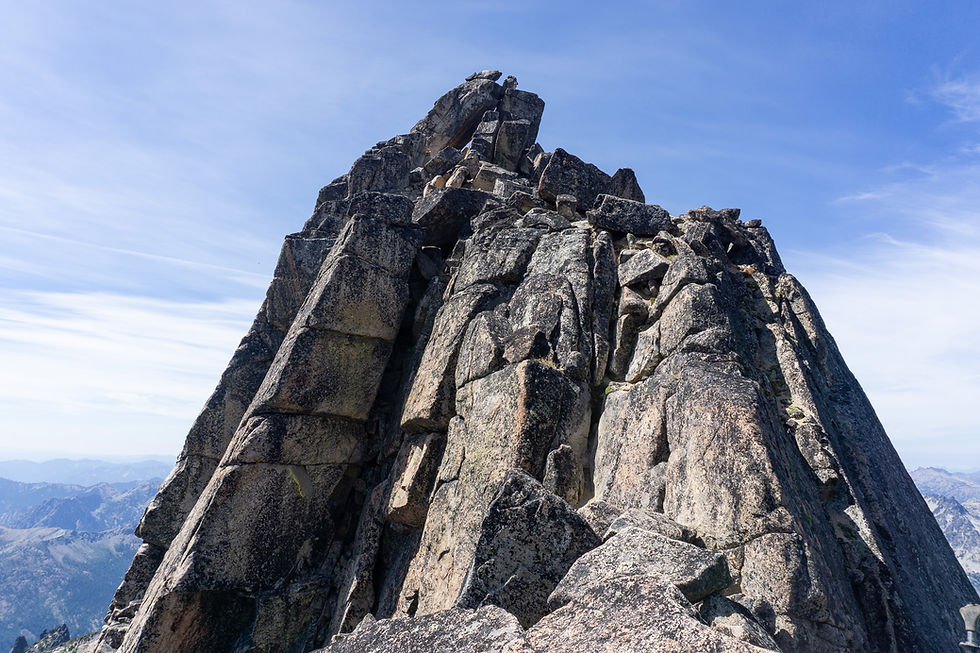
I then belayed Mike up and we had nothing but the last 100 feet or so of the east ridge between us and the summit. Thinking it was an easy romp to the summit, we scampered up, only to be confronted with one more difficulty, we couldn’t find an easy way up! I scoped out the situation and eventually decided an exposed traverse to the climber’s left of the summit block was the best way. This traverse was short, and thankfully the rock was tilted in toward the mountain, making it feel very secure to lean into the slope. It was almost as if it was designed to ease climber’s nerves as they passed this section – I would not have done it if it was downward-sloping.
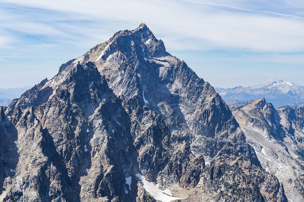


Beyond this point, a few more class 3 moves brought us up to the summit! We had beautiful views of the Stuart Range both in the direction of Colchuck and Dragontail as well as Stuart herself.
The descent was uneventful now that we knew about the key ledge. This way is very secure, just don’t look down. Back at the anchor, we rapped down the chockstone gully with our 60m rope. Downclimbing this section without a rope would have been scary, it was already awkward enough as it was to start the rappel.


Back on terra firma, we began our way down the gully, using friction and plentiful butt slides to aid our descent. It was really fun scrambling, and I was sad when we got down to more typical loose gully scree after a bit.

The rest of the way down was smooth – we found a better way around the slide alder and were able to pick up even more traces of climber’s path. We unfortunately somehow did a worse job of navigating through the deadfall zone and got suitably worked trying to balance and climb up and over dozens of logs after a long day. It was a blessing to finally reach the creek again, where we soaked our feet and mentally prepped ourselves for a slog of a climb back up Fourth Creek.
Once we crested the pass, we just had the final 3 miles of downhill to go, and we cruised into the trailhead parking lot just as dark was setting in. Many thanks to Mike for being a great partner for this one!
Final Stats: 16.32 miles / 7631 feet of gain


Comments